Home | Tibet Main | Photo Index Page | Tibet References | Contact 
Previous photo Next photo Thumbnail page
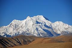
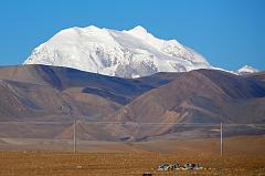
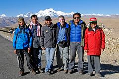
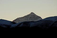
09 Pungpa Ri, Phola Gangchen And Shishapangma From Tong La 11 Gang Benchen From Tong La 12 Lobuche Kang III E, Labuche Kang, Labuche Lang II and Colangma From Tong La 20 Pemba Rinjii, Pasang, Ngawang, Jerome Ryan, Pemba, Gyan Tamang On Tong La With Shishapangma Behind 02 Mount Everest Close Up At Sunrise From Across Tingri Plain
First page Previous page Index page Next page Last page
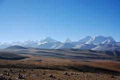
12 Lobuche Kang III E, Labuche Kang, Labuche Lang II and Colangma From Tong La  [18 of 24]


The Labuche Kang massif is part of a beautiful mountain panorama viewed from the Tong La (also called Yarle Shang La). The Labuche Kang massif is part of the Himalayan range in Tibet, located North-West of Cho Oyu, and half-way between Cho Oyu and Shishapangma. This massif has several summits over 7000m, from left to right Lobuche Kang III East (7250m), Labuche Kang (7367m, also called Lobuche Kang I or Choksiam), the pyramid-shaped Labuche Kang II (7072m) and to the far right Colangma (6952m).
12 Lobuche Kang III E, Labuche Kang, Labuche Lang II and Colangma From Tong La The Labuche Kang massif is part of a beautiful mountain panorama viewed from the Tong La (also called Yarle Shang La). The Labuche Kang massif is part of the Himalayan range in Tibet, located North-West of Cho Oyu, and half-way between Cho Oyu and Shishapangma. This massif has several summits over 7000m, from left to right Lobuche Kang III East (7250m), Labuche Kang (7367m, also called Lobuche Kang I or Choksiam), the pyramid-shaped Labuche Kang II (7072m) and to the far right Colangma (6952m).

DATE: 2010-10-13 07:31